Emergency services have confirmed that the localised flooding affecting parts of East Cheshire has largely subsided.
The flash flooding caused major issues in the Wilmslow, Poynton and Bollington areas.
The incident affected a number of properties and resulted in a number of roads closures through the local area.
Oakenclough Children's Centre was opened as an emergency rest centre for those affected by the flododing but thankfully there were no reports of any casualties.
The majority roads have now reopened, including the A34 Alderley Edge Bypass, although motorists are advised to drive with care as there is still a large amount of surface water in the area.
The following roads remain closed at this time:
· Styal Road, Wilmslow – closed in both directions
· Bonis Hall Lane, Poynton – closed in both directions
· Flash Lane, Astbury – closed in both directions
· Fol Hollow, Congleton – closed in both directions
· Mill Lane, Adlington - closed in both directions
· Moggie Lane, Higher Poynton – closed in both directions due to collapse of the bridge at the junction with Narrow Lane
· Hully Road, Macclesfield – closed in both directions due to flooding between Charter Way and Dover Road
· Skellorn Green Lane, Adlington – closed due to flooding at the junction with Street Lane and Cawley Lane
A number of other minor roads also remain closed and motorists are reminded to abide by all road closure signs.
Officers are also asking motorist who had were forced to abandon their vehicles yesterday to arrange collection as soon as possible.
A spokesperson for Cheshire East Highways said "Overnight, we have responded to over 150 highways-related flooding calls and today we will be inspecting our roads, clearing any debris & responding to further requests for assistance. "
The emergency refuge centres in Handforth and Poynton have now closed.
Residents with any issues can call the Cheshire East emergency helpline on 0300 123 5020 or 0300 123 5025.
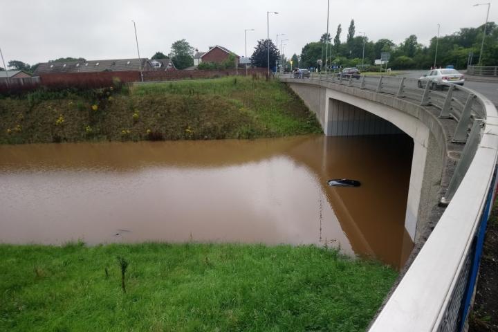
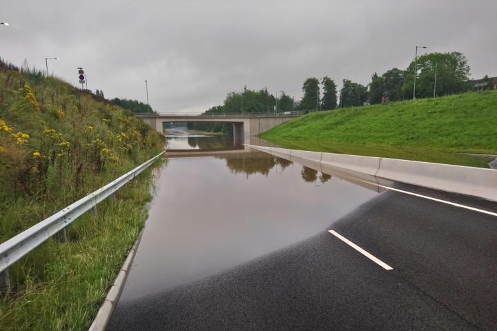
Photos: A555 at Handforth taken 1st August.


Comments
Here's what readers have had to say so far. Why not add your thoughts below.