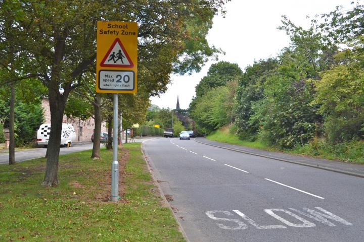


Local schools currently have School Keep Clear markings outside, which means that only the police can carry out enforcement where an obstruction is caused.
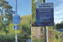
However, new No Stopping Traffic Regulation Orders will come into operation on Monday, 8th May, prohibiting vehicles from stopping in the restricted areas from Monday to Friday between 8am and 5pm and enable both the Council's own Parking Enforcement team as well as the police to enforce the markings.
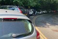
A spokesperson for Cheshire East Council said "Parking outside schools at dropping off and picking up time is a recognised, long-standing and growing national problem. Typical illegal behaviour includes parking on School Keep Clear road markings which is not just an issue of safety but a problem of traffic congestion and nuisance to pedestrians and local residents.
"It has become more and more difficult for any kind of worthwhile enforcement to be undertaken against motorists parking on these markings in spite of requests from the schools and the Police."
The effect of the orders will be to introduce No Stopping by vehicles Monday to Friday 8am to 5pm outside these schools on the following lengths and sides of road:
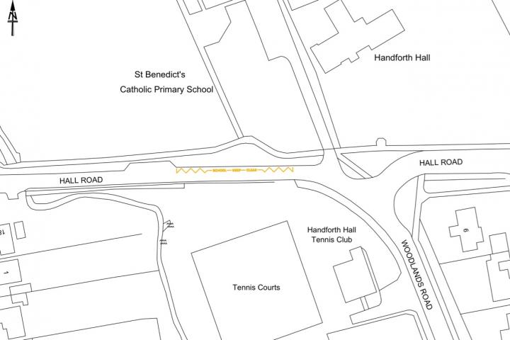
St Benedict's Catholic Primary School
Hall Road, Handforth (north side) – from a point 25 metres west of its junction with Hall Road for a distance of 37.56 metres in a westerly direction.
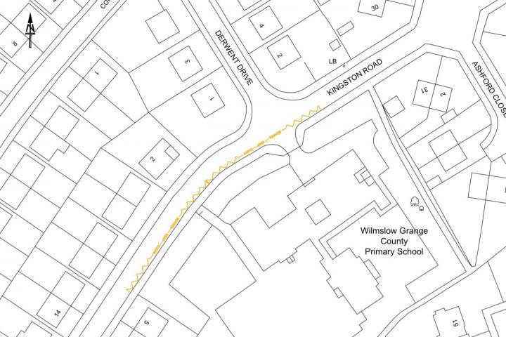
Wilmslow Grange Primary School
Ullswater Road, Handforth (south side) – from a point 12 metres north east of its junction with Derwent Drive for a distance of 91.22 metres in a south westerly direction.
Wilmslow Academy
Handforth Road, Wilmslow (south west side) – from a point 75 metres north west of its junction with Swinley Chase for a distance of 37.56 metres in a north westerly direction.
Styal Primary School
Altrincham Road, Wilmslow (south west side) – from a point 47 metres south east of a point in line with the common boundary of property names Fern Cottage and Beech Cottage for a distance of 31.56 metres in a south easterly direction.
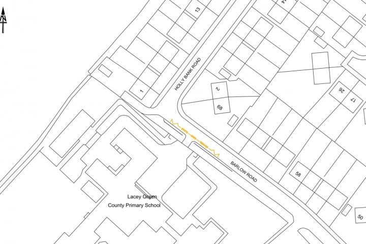
Lacey Green Primary Academy
Barlow Road, Wilmslow (south west side) – from a point 3 metres south east of its junction with Holly Bank Road for a distance of 25.56 metres in a south easterly direction.
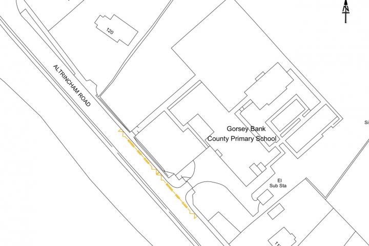
Gorsey Bank County Primary School
Altrincham Road, Wilmslow (north east side) – from a point 73 metres south east of its junction with Gorsey Road for a distance of 51.22 metres in a south easterly direction.
St Anne's Fulshaw CE Primary School
Nursery Lane, Wilmslow (west side) – from a point 34 metres south of its junction with Chapel Lane for a distance of 31.56 metres in a southerly direction.
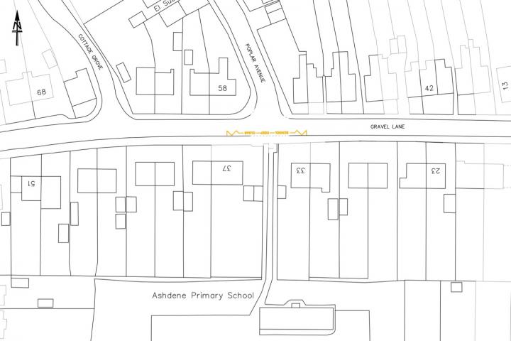
Ashdene Primary School
Gravel Lane, Wilmslow (south side) – from a point 8 metres east of its junction with Poplar Avenue for a distance of 25.56 metres in a westerly direction.
Alderley Edge School for Girls
Brook Lane, Alderley Edge (south west side) – from a point 28.5 metres north west of its junction with Wilmslow Road for a distance of 25.56 metres in a north westerly direction.
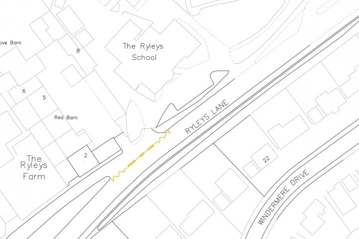
The Ryleys School
Ryleys Lane, Alderley Edge (north west side) – from a point 207 metres south west of its junction with Eaton Drive for a distance of 31.56 metres in a south westerly direction.


Comments
Here's what readers have had to say so far. Why not add your thoughts below.